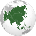
Berkas:Asia (orthographic projection).svg

Berkas si föföna sibai (Berkas SVG, 541 x 541 piksel, fa'ebua berkas: 557 KB)
Berkas andre moroi Wikimedia Commons ba te te'oguna'ö ba proyek tanö bö'ö. Deskripsi ba nga'örö deskripsi berkas te'oroma'ö tou ba da'a.
Furugönia
| FanutunöAsia (orthographic projection).svg |
العربية: الخريطة الهجائية لآسيا English: Asia |
||||
| Baŵa | |||||
| Kode |
National Geographic. Map by Ssolbergj
|
||||
| Sanura | Koyos + Ssolbergj | ||||
| Versi lainnya |
العربية: الرجاء، قراءة الميثاق.
বাংলা: দয়া করে, রীতিনীতিটি পড়ুন।
Deutsch: Bitte lies die Konventionen.
English: Please, read the conventions.
Español: Por favor, lea las convenciones.
Filipino: Paki-basa ang mga kumbensyon.
Français : S'il vous plaît, lisez les conventions.
हिन्दी: कृपया सभागमों को पढ़ लें.
Bahasa Indonesia: Silakan, baca konvensi.
Italiano: Si prega di leggere le convenzioni.
日本語: 規約をご確認ください。
ქართული: გთხოვთ, გაეცნოთ კონვენციებს.
Македонски: Ве молиме, прочитајте ги општоприфатените правила.
Português: Por favor, leia as convenções.
Русский: Пожалуйста, прочитайте соглашения.
Tagalog: Paki-basa ang mga kumbensyon.
Українська: Будь ласка, прочитайте конвенції.
Tiếng Việt: Hãy đọc công văn trước khi đăng.
|
||||
| SVG genesis InfoField | Gambar vektor ini dibuat menggunakan unknown tool |
Lisensi

|
Tetehegö wangai, wame'e ma wamulö'ö dokumen andre faoma Lisensi Dokumentasi Bebas GNU, Versi 1.2 ma zui sabölö afuria nifataro Free Software Foundation; lö Seksi Invarian, lö teks uli föna, ba lö teks uli furi. Kopi lisensi no tefaogö ba waosatö sotöi Lisensi Dokumentasi Bebas GNU.http://www.gnu.org/copyleft/fdl.htmlGFDLGNU Free Documentation Licensetruetrue |
- Tola ölau:
- fa'ohe'ö – wo-kopi, distribusi ba transmisi mbua halöŵö
- mamaruka – mamulö'ö ba mamazökhi zibohou moroi ba halöŵö andre
- Molo'ö kondisi andre:
- atribusi – Si lö tola lö'ö ösura kredit, khai-khai silalö ba lisensi ba ombakha'ö na so nifabö'öni. Tola ölau ia molo'ö fangera-ngerau, ba hiza böi sura wa no ifarou ndra'ugö sololohe lisensi.
- fa'ohe'ö – Na öbulö'ö ba öfazikhi zi bohou moroi ba halöŵö andre, si lö tola lö'ö öbe'e kontribusimö faoma same or compatible license simane lisensi halöŵö asli.
| Annotations InfoField | This image is annotated: View the annotations at Commons |
India
Sri Lanka
Russia
Mongolia
China
Africa
Oceania
South Korea
North America
Europe
North Korea
Japan
Pakistan
Saudi Arabia
Kazakhstan
Papua New Guinea
Indonesia
Nepal
Iran
Cyprus
Kamchatka
Hokkaido
Cambodia
Turkey
Afghanistan
Bhutan
Philippines
Malaysia
Thailand
Vietnam
Captions
Items portrayed in this file
menggambarkan Indonesia
status hak cipta Indonesia
berhak cipta Indonesia
lisensi Indonesia
sejak Indonesia
15 Maret 2009
tipe media Indonesia
image/svg+xml
checksum Inggris
172f5e66318d09590c698956d4edb40320c8ce53
ukuran data Indonesia
570.850 Bita
tinggi Indonesia
541 piksel
lebar Indonesia
541 piksel
Waö-waö berkas
Höndrögö ba mbaŵa/ginötö wamaigi hewisa berkas ba ginötö andrö
| Baŵa/Inötö | Khala-khala berkas | Su'a-su'a | Sangoguna'ö | Komentar | |
|---|---|---|---|---|---|
| fondrege bohou | 30 Juli 2023 01.11 |  | 541 × 541 (557 KB) | Bennylin | synchronize with File:Southeast Asia (orthographic projection).svg. Source: File:United Nations geographical subregions.png |
| 18 Maret 2023 07.57 |  | 541 × 541 (496 KB) | Golden Mage | A change to the map of Asia will first face debate from others. Hence, a change to the commonly accepted map of Oceania cannot be made without a wider consensus. | |
| 17 Maret 2023 10.44 |  | 541 × 541 (557 KB) | Kwamikagami | the Weber line divides Asian from Oceanic Wallacea | |
| 5 September 2022 02.29 |  | 541 × 541 (496 KB) | Рагин1987 | Socotra repainted | |
| 5 September 2022 00.20 |  | 541 × 541 (492 KB) | Рагин1987 | Final edit | |
| 4 September 2022 19.43 |  | 541 × 541 (446 KB) | Рагин1987 | Correction | |
| 31 Agustus 2022 20.13 |  | 2.048 × 2.048 (1,04 MB) | Рагин1987 | Small correction (Socotra Island is geologically closer to Africa) | |
| 14 Desember 2019 00.59 |  | 541 × 541 (242 KB) | Goran tek-en | Added border for South Sudan as requested by {{u|Maphobbyist}} | |
| 13 Februari 2019 17.16 |  | 541 × 541 (161 KB) | عبد الله | Reverted to version as of 16:47, 19 September 2016 (UTC) | |
| 13 Februari 2019 17.11 |  | 512 × 512 (120 KB) | عبد الله | إزاة خطوط زعجة |
Fangoguna'ö berkas
Te'oguna'ö ba nga'örö andre berkas:
Fangoguna'ö berkas global
Wiki tanö bö'ö sangoguna'ö berkas andre
- Fangoguna'ö ba ab.wikipedia.org
- Fangoguna'ö ba ace.wikipedia.org
- Fangoguna'ö ba ady.wikipedia.org
- Fangoguna'ö ba af.wikipedia.org
- Afrika
- Asië
- Europa
- Filippyne
- Irak
- Israel
- Japan
- Noord-Amerika
- Suid-Amerika
- Volksrepubliek China
- Thailand
- Singapoer
- Maleisië
- Afghanistan
- Sjabloon:Kontinente
- Bangkok
- Katar
- Taipei
- Indië
- Rusland
- Oesbekistan
- Hoofstad
- Lys van hoofstede
- Siprus
- Armenië
- Sjabloon:Lande van Asië
- Iran
- Egipte
- Wikipedia:Sjabloon
- Turkmenistan
- Wikipedia:Lys van sjablone
- Britse Indiese Oseaangebied
- Suid-Korea
- Noord-Korea
- Antarktika
- Beijing
- Gondwana
- Eurasië
- Laurasië
- Kategorie:Lande in Asië
- Libanon
- Jerusalem
- Azerbeidjan
- Bahrein
Faigi more global usage berkas andre.
Metadata
So nönö-nönö informasi si so bakha ba berkas andre, ninönö kamera digital ma scanner me lafazökhi ia. Na no tefabulö berkas, ba tola manö wa so zi lö faoma ba informasi berkas si no mufabö'öni.
| Lebar | 541.48 |
|---|---|
| Tinggi | 541.48 |


